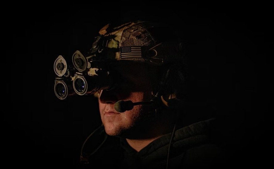
What type of navigation tools should you have for SHTF?

In the face of disasters and emergencies, the distinction lies in their impact on the landscape, with emergencies leaving it unchanged while disasters have the potential to completely transform everything we know. Countless factors such as floods, riots, terrorist attacks, or nuclear war can reshape our country and significantly affect navigation.
To navigate effectively, it is essential to disassociate from nostalgic feelings and approach every location as if encountering it for the first time. While daily navigation may seem effortless in our modern era of GPS devices and mobile map apps, it is crucial to prioritize navigation in survival and emergency preparedness planning.
The potential failure of the grid, compromised cell networks, or targeted GPS satellites can leave younger generations struggling to find their way, even within their own towns or when attempting to reach safety outside danger zones. Carrying a compass and considering the inclusion of other navigation items in your emergency preparations is prudent.
Understanding the Limitations of Modern Navigation Technology:
In the midst of critical situations, when emergencies strike or large-scale disruptions occur, relying solely on GPS can prove to be challenging. Various factors can hinder the functionality of GPS and leave individuals without the vital services they depend on.
1. Grid failures - One of these factors is grid failures, which can arise from natural disasters, cyber-attacks, or issues with infrastructure. When the power grid goes down, it triggers widespread power outages, rendering GPS devices useless. Without a stable power supply, the GPS technology that relies on it becomes inoperable, leaving individuals without access to location and navigation information.
2. Compromised cell networks – this poses another threat to GPS functionality during emergencies or malicious attacks. When cellular infrastructure is disrupted or overloaded, GPS signal and communication capabilities are affected. Without a reliable cellular connection, GPS devices fail to receive the necessary data, making them ineffective tools for navigation.
3. Targeted satellite attacks - to make matters worse, targeted attacks on GPS satellites can have dire consequences. These satellites play a critical role in transmitting signals that enable GPS devices to determine accurate locations. However, deliberate tampering or destruction of these satellites severely compromises the availability and reliability of GPS signals. The result is a technology that can no longer be trusted for navigation purposes.
Benefits of Alternative Navigation Approaches
When it comes to navigation, it's essential to understand why relying solely on GPS may not always suffice. That's why considering alternative methods becomes crucial. Let's take a closer look at the reasons behind this and explore the importance of having backup options, especially in critical situations.
1. Adverse weather conditions – this condition might have rendered your GPS device useless. Water damage, extreme cold, or physical damage can take their toll, leaving you without a reliable means of navigation. It is during these times that having alternative tools, such as a trusty compass, can be a saving grace.

2. Concerns on battery life - in such situations, conserving power becomes paramount. The last thing you want is to drain your device's battery on non-essential services, leaving you stranded without the means to navigate. A compass, on the other hand, requires no power source and serves as a reliable backup option when every bit of energy counts.
3. Portability of Compass - consider a scenario where you find yourself in an emergency, and the GPS device integrated into your vehicle or the bulky laptop you carry becomes impractical for navigation. The weight and inconvenience of these devices may hinder your movement, making it harder to navigate effectively. This is where the portability and ease of use offered by a compass truly shine. Its compact size and simplicity make it an ideal companion in emergency situations, ensuring you can find your way with ease.
4. Proficiency requirements in operating GPS - another factor to consider is the proficiency required to operate GPS systems effectively. Technology evolves rapidly, and keeping up with system upgrades and advancements can be challenging. If you find yourself lost and unable to navigate due to unfamiliarity with the latest GPS features, the importance of having knowledge in alternative navigation methods becomes apparent. A compass, with its timeless simplicity, requires no upgrades or technological know-how, allowing you to navigate confidently regardless of the latest developments.
5. Power Outages and System Failures - the vulnerability of GPS functionality to power outages or system failures is a cause for concern. When circumstances beyond your control disrupt the power supply or compromise the system, your GPS device becomes nothing more than a dormant gadget. In these situations, having a reliable alternative, such as a trusty compass, ensures that you can navigate even when the technological infrastructure fails you.
6. Threat of Electromagnetic Pulse Attacks - these attacks can wreak havoc on electronic equipment, including GPS devices, resulting in service degradation or a complete shutdown of the GPS system. When faced with such an event, relying solely on GPS becomes a gamble. However, a compass remains unaffected by these attacks, offering a dependable means of finding your way amidst the chaos.
Usefulness of Paper Maps and Compass:
Paper Maps
In the vast expanse of the digital world, where screens offered glimpses into specific locations, paper maps revealed a grander perspective. Digital maps allowed users to zoom in and out, but they often lacked the ability to showcase a complete region or country on a single screen. On the other hand, paper maps unfolded like ancient scrolls, unveiling an entire landscape before your eyes. With one sweeping glance, you could grasp the interconnections between different places, understanding the lay of the land in all its glory.
Reliability was another trait that set paper maps apart from their digital counterparts. While digital maps were prone to glitches, errors, and technological mishaps, paper maps remained steadfast and dependable. They required no batteries, no internet connection, nor any external power source. Armed with a trusty paper map and a faithful compass, you could navigate through rugged terrains and uncharted paths, undeterred by the limitations of technology.
But it wasn't just reliability that made paper maps invaluable; they also boasted independence from technology. In the remote corners of the world, where cell service and Wi-Fi signals faded into oblivion, a paper map became a lifeline. It guided adventurers, explorers, and wayfarers through dense forests, barren deserts, and towering mountains, offering a sense of direction when all else seemed lost. With a paper map in hand, one could find their way back to civilization, no matter how far off the beaten path they had ventured.
Yet, the allure of paper maps extended beyond functionality and practicality. There was something magical about holding a tangible map in your hands, feeling its creases beneath your fingertips, and tracing the contours of the land with your gaze. It was a sensory experience that no digital map could replicate. As you unfolded the map, a sense of wonder and anticipation filled the air. It was an invitation to immerse yourself in the natural world, to disconnect from the constant stimulation of technology, and to truly engage with the surroundings.
Compass
However, a map alone is not enough. It is the combination of a map and a compass that truly unlocks the full potential of navigation. The compass acts as your trusty guide, pointing you in the right direction and helping you maintain a steady course. With the compass needle aligning itself with the Earth's magnetic field, you can confidently follow the designated bearing indicated on your map. This symbiotic relationship between the compass and the map ensures accuracy and precision in your navigation, even in the most challenging situations.
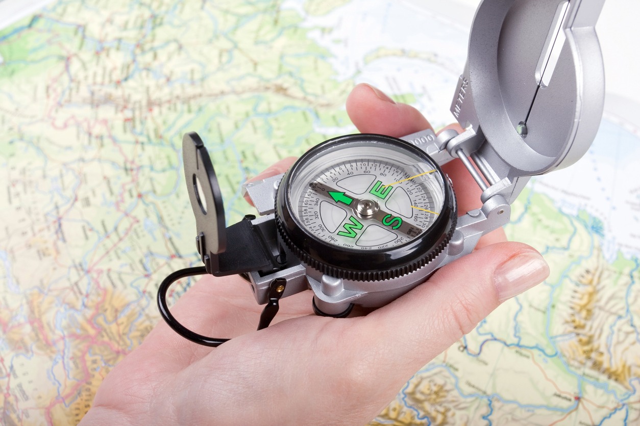
So, when the SHTF and you find yourself in unfamiliar territory, never underestimate the power of the map and compass. Together, they provide you with a comprehensive understanding of your surroundings, highlight key landmarks, guide your route planning, and ultimately lead you to safety. Embrace the synergy of these essential tools, and you'll find yourself navigating with confidence, even in the face of adversity.
Vital Navigation Skills:
Navigation skills are a fundamental asset for anyone traversing unfamiliar terrain or encountering unexpected situations. Mastering navigation requires a combination of knowledge, experience, and the ability to interpret and use various tools effectively. It involves understanding maps, compasses, landmarks, and celestial bodies, as well as developing a keen sense of observation and intuition. With honed navigation skills, one can confidently navigate through complex terrains, find their way in low visibility conditions, and make informed decisions when planning routes. These skills empower individuals to explore new environments, embark on outdoor adventures, and ensure their safety and well-being during journeys near and far.
1. Map Reading - proficiency in reading and interpreting maps is essential for navigation. This skill involves understanding symbols, contours, scale, and legends on a map to determine one's location, plan routes, and identify prominent features such as rivers, mountains, and roads.
2. Compass Use - knowing how to use a compass allows individuals to determine directions accurately. By aligning the compass needle with the map's orientation, they can navigate along specific headings, adjust for declination, and maintain a sense of direction even in areas without visible landmarks or during low visibility conditions.
3. Landmark Identification - recognizing and using prominent landmarks is crucial for navigation. These can include distinctive natural features like mountains, lakes, or rock formations, as well as man-made structures such as buildings or towers. Landmarks serve as reference points, helping to confirm one's position and navigate along a desired path.
4. Route Planning - effective navigation involves planning routes before embarking on a journey. This skill entails considering factors such as distance, terrain difficulty, elevation changes, and potential obstacles. By carefully planning the route, individuals can optimize their travel time, conserve energy, and avoid hazardous areas.
5. Dead Reckoning - this is a technique used to estimate one's current position based on a previously known position, speed, and elapsed time. It involves maintaining a mental or written record of distance traveled and direction taken, making adjustments for any changes in speed or direction to estimate one's approximate location.
6. Celestial Navigation - it involves using the sun, moon, stars, and other celestial bodies to determine direction and approximate position. This skill is particularly useful when other navigation tools are unavailable or compromised, allowing individuals to navigate by observing celestial objects and their movements in the sky.
7. Observation and Intuition - developing keen observation skills and intuition is essential for navigation. It involves paying attention to subtle environmental cues, such as changes in vegetation, wind patterns, or animal behavior, which can provide valuable information about one's surroundings and help in making navigation decisions.
Additional Navigational Tools:
1. GPS Devices - this device use signals from satellites to determine your precise location. They provide real-time positioning, accurate maps, and can even give turn-by-turn directions. GPS devices are popular for their convenience and accuracy in outdoor activities.
2. Smartphone Apps - navigation apps on smartphones utilize GPS technology to offer detailed maps, turn-by-turn directions, and real-time traffic information. Popular apps like Google Maps, Apple Maps, and Waze provide various features to help with navigation.
3. Altimeters - this tool measure altitude or elevation above sea level. They are useful in mountainous regions or during hiking and climbing, allowing you to track changes in elevation and estimate remaining ascent or descent based on topographical information.
4. Marine Navigation Tools - tools such as marine charts, compasses, and marine GPS devices are used for navigation at sea. Marine charts provide detailed information about coastlines, depths, and navigational aids, while marine GPS devices offer precise positioning and course plotting specifically designed for marine navigation.
5. Sextants -these are instruments used primarily in celestial navigation. They allow users to measure the angle between celestial bodies, such as the sun or stars, and the horizon to determine their position on the Earth's surface. Sextants are still used in certain maritime and aviation contexts as backup navigation tools or in areas without electronic navigation devices.
6. Electronic Chart Plotters - this tool combines GPS technology with digital charts to provide detailed navigation information on a screen. These devices are commonly used in boating and sailing, allowing users to track their position, plan routes, and monitor real-time vessel data like speed and heading.
7. Pedometers - this tool count the number of steps taken by an individual. While primarily used for fitness purposes, they can also be helpful in estimating distance traveled during navigation, especially when more accurate measuring devices are unavailable.
Conclusion:
In survival and emergency situations, having reliable navigation tools is crucial. Although modern technology provides convenience, it's important to understand its limitations and have backup methods in place. Using a compass, topographic maps, natural navigation skills, and other additional navigation tool creates a comprehensive toolkit that improves your navigation abilities with accuracy and confidence. Regular practice and becoming familiar with these tools are essential for refining your navigation skills and ensuring your safety during difficult circumstances. Remember, dedicating time and effort to mastering navigation can be a life-saving pursuit in times of disaster.